Geolocate

Mounts topographic map

Click on the map to display elevation.

About this map

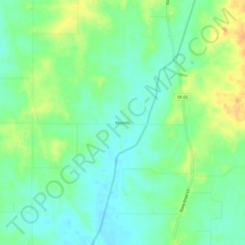
Name: Mounts topographic map, elevation, terrain.

Location: Mounts, Gibson County, Indiana, 47612, United States (38.21060 -87.72641 38.25060 -87.68641)

Average elevation: 463 ft

Minimum elevation: 420 ft

Maximum elevation: 528 ft

Gibson County trails, hiking, mountain biking, running and outdoor activities

Other topographic maps

Click on a map to view its topography, its elevation and its terrain.

Haubstadt

United States > Indiana > Gibson County

Average elevation: 463 ft

Oakland City

United States > Indiana > Gibson County

Average elevation: 456 ft

Patoka River

United States > Indiana > Gibson County

Average elevation: 423 ft

Patoka

United States > Indiana > Gibson County

Average elevation: 440 ft

Francisco

United States > Indiana > Gibson County

Average elevation: 459 ft

Somerville

United States > Indiana > Gibson County

Average elevation: 495 ft

Hazleton

United States > Indiana > Gibson County

Average elevation: 430 ft

Mackey

United States > Indiana > Gibson County

Average elevation: 430 ft

Fort Branch

United States > Indiana > Gibson County

Average elevation: 446 ft

Gear up for your next adventure:

🩳Quick‑Dry Hiking Shorts - Comfortable and quick‑dry shorts for summer hiking
🧤Tactile Hiking Gloves - Keep hands warm while operating GPS and smartphone screens
🧦Merino Wool Socks - Moisture-wicking, blister-preventing socks for long treks
GPS Sports Watch - GPS watch for running, hiking and training
🌡️Handheld Weather Meters - Measure wind, temp, and pressure for safe mountain travel

As an Amazon Associate, this site earns from qualifying purchases at no extra cost to you.