
Thank you for supporting this site ❤️
Make a donation
Make a donation
Gear up for your next adventure:
As an Amazon Associate, this site earns from qualifying purchases at no extra cost to you.
Grauspitz topographic map
Click on the map to display elevation.
Thank you for supporting this site ❤️
Make a donation
Make a donation
Gear up for your next adventure:
As an Amazon Associate, this site earns from qualifying purchases at no extra cost to you.
About this map
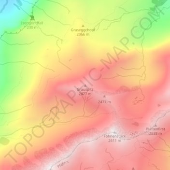
Name: Grauspitz topographic map, elevation, terrain.
Location: Grauspitz, Mels, Wahlkreis Sarganserland, Sankt Gallen, Schweiz (46.94962 9.28619 46.94972 9.28629)
Average elevation: 7,018 ft
Minimum elevation: 4,583 ft
Maximum elevation: 8,468 ft
Thank you for supporting this site ❤️
Make a donation
Make a donation
Gear up for your next adventure:
As an Amazon Associate, this site earns from qualifying purchases at no extra cost to you.