
Thank you for supporting this site ❤️
Make a donation
Make a donation
Gear up for your next adventure:
As an Amazon Associate, this site earns from qualifying purchases at no extra cost to you.
Golzern topographic map
Click on the map to display elevation.
Thank you for supporting this site ❤️
Make a donation
Make a donation
Gear up for your next adventure:
As an Amazon Associate, this site earns from qualifying purchases at no extra cost to you.
About this map
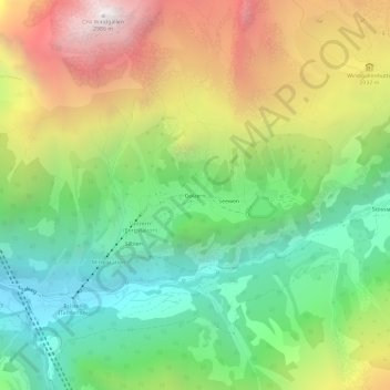
Name: Golzern topographic map, elevation, terrain.
Location: Golzern, Silenen, Uri, 6475, Suisse (46.75701 8.70963 46.79701 8.74963)
Average elevation: 5,476 ft
Minimum elevation: 2,612 ft
Maximum elevation: 9,724 ft
Thank you for supporting this site ❤️
Make a donation
Make a donation
Gear up for your next adventure:
As an Amazon Associate, this site earns from qualifying purchases at no extra cost to you.