Geolocate

Adamville topographic map

Click on the map to display elevation.

About this map
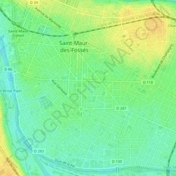
Name: Adamville topographic map, elevation, terrain.

Location: Adamville, Saint-Maur-des-Fossés, Nogent-sur-Marne, Val-de-Marne, Île-de-France, France métropolitaine, 94100, France (48.78860 2.47130 48.80520 2.50278)

Average elevation: 135 ft

Minimum elevation: 95 ft

Maximum elevation: 180 ft

Other topographic maps

Click on a map to view its topography, its elevation and its terrain.
Gear up for your next adventure:

🌐World Map Poster - Decorative world maps with topographic info
🧭Outdoor Navigation Book - Learn advanced navigation skills
📱Heavy-Duty Phone Cases - Drop-proof and waterproof protection for outdoor navigation
🧦Hiking Socks - Comfortable socks to prevent blisters on long hikes
🧥Men's Rain Shells - Premium waterproof and breathable jackets for mountain weather

As an Amazon Associate, this site earns from qualifying purchases at no extra cost to you.