
Make a donation
Gear up for your next adventure:
As an Amazon Associate, this site earns from qualifying purchases at no extra cost to you.
Ibersheim topographic map
Click on the map to display elevation.
Make a donation
Gear up for your next adventure:
As an Amazon Associate, this site earns from qualifying purchases at no extra cost to you.
Ibersheim
1621 eroberten die spanischen Truppen der kaiserlich-katholischen Liga unter ihrem Kommandeur Gonzalo Fernández de Córdoba die Burg Stein und errichteten ihr Lager zwischen Ibersheim und Rheindürkheim. 1631 beim Herannahen der Schweden unter Gustav II. Adolf wurde die Burg und die Pontonbrücke von den Besetzern in Brand gesteckt. – Matthäus Merian hat die Burg noch während der spanischen Besatzung und vor der schwedischen Zerstörung darstellen können. In der Topographia Germaniae erfolgte die Veröffentlichung mit einer guten Darstellung für die Zukunft.
Make a donation
Gear up for your next adventure:
As an Amazon Associate, this site earns from qualifying purchases at no extra cost to you.
About this map
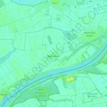
Name: Ibersheim topographic map, elevation, terrain.
Average elevation: 292 ft
Minimum elevation: 276 ft
Maximum elevation: 341 ft
Make a donation
Gear up for your next adventure:
As an Amazon Associate, this site earns from qualifying purchases at no extra cost to you.
Other topographic maps
Click on a map to view its topography, its elevation and its terrain.
Worms
Deutschland > Rheinland-Pfalz > Worms
Das langjährige Mittel der Lufttemperatur des Zeitraums 1951 bis 1980 beträgt 10,3 °C. In den vergangenen Jahren wurde eine Steigerung des Jahresmittels der Lufttemperatur beobachtet. So betrug im Jahr 2008 die gemittelte Lufttemperatur an der Hagenstraße 12,2 °C, während im gleichen Zeitraum fünf…
Average elevation: 328 ft