

Skoura topographic map
Click on the map to display elevation.
Skoura
Many of these rivers remain dry outside the spring period, which has required a careful and elaborate system of irrigation and water preservation within the oasis. This system draws from both surface waters and subterranean waters. A series of khettaras (a type of underground canal) draws subterranean waters from the phreatic table in the higher-elevation regions of the mountain foothills and brings them to reservoirs in the oasis. At the same time, a series of dams along the main rivers allows for some of the surface waters to be diverted as well. From these reservoirs water is then distributed via a network of irrigation canals (seguias) to the various agricultural plots. This water supply system was collectively shared and maintained by the entire population of the oasis, with landowners agreeing to take turns to receive water for their crops. Alongside the palms a variety of common crops were grown such as dates, other fruit trees, vegetables, and cereals.
About this map
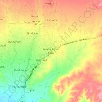
Name: Skoura topographic map, elevation, terrain.
Average elevation: 4,012 ft
Minimum elevation: 3,796 ft
Maximum elevation: 4,209 ft