Geolocate

Trebanog topographic map

Click on the map to display elevation.

About this map

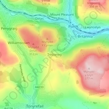
Name: Trebanog topographic map, elevation, terrain.

Location: Trebanog, Rhondda Cynon Taf, Wales, CF39 9EW, United Kingdom (51.58226 -3.43952 51.62226 -3.39952)

Average elevation: 689 ft

Minimum elevation: 279 ft

Maximum elevation: 1,237 ft

Gear up for your next adventure:

🔭Stargazing Telescopes - Perfect for camping in low-light pollution areas shown on maps
🔋Solar Power Banks - Keep your GPS and phone charged in remote wilderness areas
🧭Outdoor Navigation Book - Learn advanced navigation skills
😴Insulated Sleeping Pads - Compact and warm pads for high-elevation camping
🗻Climbing Gear Basics - Essential gear for beginner climbers

As an Amazon Associate, this site earns from qualifying purchases at no extra cost to you.