
Bear River South topographic map
Interactive map
Click on the map to display elevation.
About this map
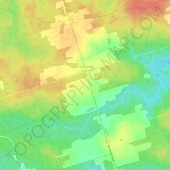
Name: Bear River South topographic map, elevation, terrain.
Average elevation: 174 ft
Minimum elevation: 89 ft
Maximum elevation: 253 ft
Other topographic maps
Click on a map to view its topography, its elevation and its terrain.
Rollo Bay
Canada > Prince Edward Island > Lot 44
Rollo Bay, Lot 44, Kings County, Prince Edward Island, Canada
Average elevation: 62 ft
Saint Margarets
Canada > Prince Edward Island > Lot 44
Saint Margarets, Lot 44, Kings County, Prince Edward Island, Canada
Average elevation: 82 ft