
Thank you for supporting this site ❤️
Make a donation
Make a donation
Gear up for your next adventure:
As an Amazon Associate, this site earns from qualifying purchases at no extra cost to you.
Svishtov topographic map
Click on the map to display elevation.
Thank you for supporting this site ❤️
Make a donation
Make a donation
Gear up for your next adventure:
As an Amazon Associate, this site earns from qualifying purchases at no extra cost to you.
About this map
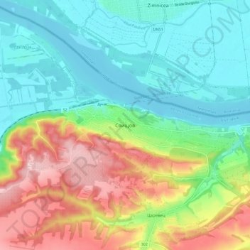
Name: Svishtov topographic map, elevation, terrain.
Location: Svishtov, Veliko Tarnovo, 5250, Bulgaria (43.57588 25.31095 43.65588 25.39095)
Average elevation: 302 ft
Minimum elevation: 46 ft
Maximum elevation: 794 ft
Thank you for supporting this site ❤️
Make a donation
Make a donation
Gear up for your next adventure:
As an Amazon Associate, this site earns from qualifying purchases at no extra cost to you.