
Thank you for supporting this site ❤️
Make a donation
Make a donation
Gear up for your next adventure:
As an Amazon Associate, this site earns from qualifying purchases at no extra cost to you.
Maripí topographic map
Click on the map to display elevation.
Thank you for supporting this site ❤️
Make a donation
Make a donation
Gear up for your next adventure:
As an Amazon Associate, this site earns from qualifying purchases at no extra cost to you.
About this map
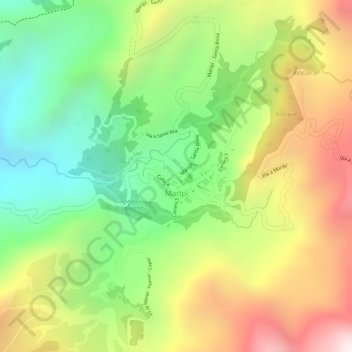
Name: Maripí topographic map, elevation, terrain.
Location: Maripí, Occidente, Boyacá, 154820, Colombia (5.54806 -74.00753 5.55349 -73.99987)
Average elevation: 4,508 ft
Minimum elevation: 3,215 ft
Maximum elevation: 5,984 ft
Thank you for supporting this site ❤️
Make a donation
Make a donation
Gear up for your next adventure:
As an Amazon Associate, this site earns from qualifying purchases at no extra cost to you.