
Thank you for supporting this site ❤️
Make a donation
Make a donation
Gear up for your next adventure:
As an Amazon Associate, this site earns from qualifying purchases at no extra cost to you.
Botyre topographic map
Click on the map to display elevation.
Thank you for supporting this site ❤️
Make a donation
Make a donation
Gear up for your next adventure:
As an Amazon Associate, this site earns from qualifying purchases at no extra cost to you.
About this map
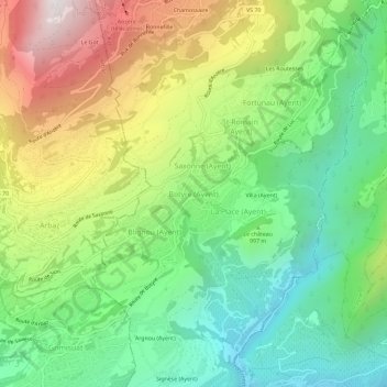
Name: Botyre topographic map, elevation, terrain.
Location: Botyre, Ayent, Ering, Wallis, 1966, Schweiz (46.25724 7.38859 46.29724 7.42859)
Average elevation: 3,327 ft
Minimum elevation: 1,644 ft
Maximum elevation: 6,106 ft
Thank you for supporting this site ❤️
Make a donation
Make a donation
Gear up for your next adventure:
As an Amazon Associate, this site earns from qualifying purchases at no extra cost to you.