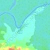
Leticia topographic map
Click on the map to display elevation.
Leticia
Leticia (Spanish pronunciation: [leˈtisja]) is the southernmost city in the Republic of Colombia, capital of the department of Amazonas, Colombia's southernmost town (4.09° south 69.57° west) and one of the major ports on the Amazon River. It has an elevation of 96 meters (315') above sea level and an average temperature of 27 °C (80.6 °F). Leticia has long been Colombia's shipping point for tropical fish for the aquarium trade. Leticia has a population of 33,503 located on the left bank of the Amazon River at the point where the borders of Colombia, Brazil and Peru meet in an area called Tres Fronteras. It is the largest Colombian settlement in the Southern Hemisphere.
About this map
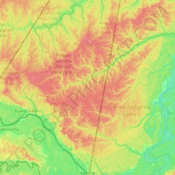
Name: Leticia topographic map, elevation, terrain.
Location: Leticia, Amazonas, RAP Amazonía, Colombia (-4.22809 -70.36640 -3.00236 -69.71408)
Average elevation: 318 ft
Minimum elevation: 164 ft
Maximum elevation: 600 ft
Other topographic maps
Click on a map to view its topography, its elevation and its terrain.
Leticia
Leticia (Spanish pronunciation: [leˈtisja]) is the southernmost city in the Republic of Colombia, capital of the department of Amazonas, Colombia's southernmost town (4.09° south 69.57° west) and one of the major ports on the Amazon River. It has an elevation of 96 meters (315') above sea level and an…
Average elevation: 233 ft