
Make a donation
Gear up for your next adventure:
As an Amazon Associate, this site earns from qualifying purchases at no extra cost to you.
Blenheim topographic map
Click on the map to display elevation.
Make a donation
Gear up for your next adventure:
As an Amazon Associate, this site earns from qualifying purchases at no extra cost to you.
About this map
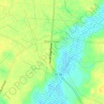
Name: Blenheim topographic map, elevation, terrain.
Location: Blenheim, Marlboro County, South Carolina, United States (34.49905 -79.66057 34.51667 -79.64487)
Average elevation: 118 ft
Minimum elevation: 72 ft
Maximum elevation: 157 ft
Marlboro County trails, hiking, mountain biking, running and outdoor activities
Make a donation
Gear up for your next adventure:
As an Amazon Associate, this site earns from qualifying purchases at no extra cost to you.
Other topographic maps
Click on a map to view its topography, its elevation and its terrain.
Country Club Heights
United States > South Carolina > Marlboro County > Bennettsville
Average elevation: 164 ft