
Make a donation
Gear up for your next adventure:
As an Amazon Associate, this site earns from qualifying purchases at no extra cost to you.
Oak Grove topographic map
Click on the map to display elevation.
Make a donation
Gear up for your next adventure:
As an Amazon Associate, this site earns from qualifying purchases at no extra cost to you.
About this map
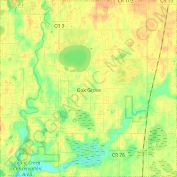
Name: Oak Grove topographic map, elevation, terrain.
Location: Oak Grove, Anoka County, Minnesota, 55011, United States (45.29799 -93.38883 45.38483 -93.26532)
Average elevation: 906 ft
Minimum elevation: 850 ft
Maximum elevation: 945 ft
Anoka County trails, hiking, mountain biking, running and outdoor activities
Make a donation
Gear up for your next adventure:
As an Amazon Associate, this site earns from qualifying purchases at no extra cost to you.
Other topographic maps
Click on a map to view its topography, its elevation and its terrain.
Rum River North County Park
United States > Minnesota > Anoka County > Saint Francis
Average elevation: 915 ft
Make a donation
Gear up for your next adventure:
As an Amazon Associate, this site earns from qualifying purchases at no extra cost to you.