Geolocate

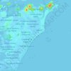
Xuri topographic map

Click on the map to display elevation.

About this map

Name: Xuri topographic map, elevation, terrain.

Location: Xuri, Vila Velha, Espírito Santo, Região Sudeste, 29125-520, Brasil (-20.49781 -40.45365 -20.45781 -40.41365)

Average elevation: 102 ft

Minimum elevation: 16 ft

Maximum elevation: 220 ft

Other topographic maps

Click on a map to view its topography, its elevation and its terrain.

Rio Aribiri

Brasil > Espírito Santo > Vila Velha

Average elevation: 7 ft

Santos Dumont

Brasil > Espírito Santo > Vila Velha

Average elevation: 16 ft

São Torquato

Brasil > Espírito Santo > Vila Velha

Average elevation: 62 ft

Riviera da Barra

Brasil > Espírito Santo > Vila Velha

Average elevation: 10 ft

Gear up for your next adventure:

🌎3D Topographic Globes - Raised relief globes for a tactile understanding of geography
🪵Folding Camp Saw - Compact saw for wood and campsite work
🎒Gear Packing Cubes - Organize your backpack efficiently
🕶️GPS Smartphone Mount - Secure mount for phone navigation
🪓Survival Multi‑Tool - Versatile tool for camp and trail tasks

As an Amazon Associate, this site earns from qualifying purchases at no extra cost to you.