
Thank you for supporting this site ❤️
Make a donation
Make a donation
Gear up for your next adventure:
As an Amazon Associate, this site earns from qualifying purchases at no extra cost to you.
Tarsogno topographic map
Click on the map to display elevation.
Thank you for supporting this site ❤️
Make a donation
Make a donation
Gear up for your next adventure:
As an Amazon Associate, this site earns from qualifying purchases at no extra cost to you.
About this map
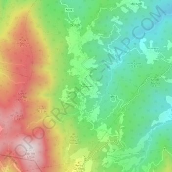
Name: Tarsogno topographic map, elevation, terrain.
Location: Tarsogno, Tornolo, Parma, Emilia-Romagna, Italy (44.42974 9.60441 44.46974 9.64441)
Average elevation: 2,913 ft
Minimum elevation: 1,768 ft
Maximum elevation: 4,626 ft
Thank you for supporting this site ❤️
Make a donation
Make a donation
Gear up for your next adventure:
As an Amazon Associate, this site earns from qualifying purchases at no extra cost to you.