
Thank you for supporting this site ❤️
Make a donation
Make a donation
Gear up for your next adventure:
As an Amazon Associate, this site earns from qualifying purchases at no extra cost to you.
Parsanga topographic map
Click on the map to display elevation.
Thank you for supporting this site ❤️
Make a donation
Make a donation
Gear up for your next adventure:
As an Amazon Associate, this site earns from qualifying purchases at no extra cost to you.
About this map
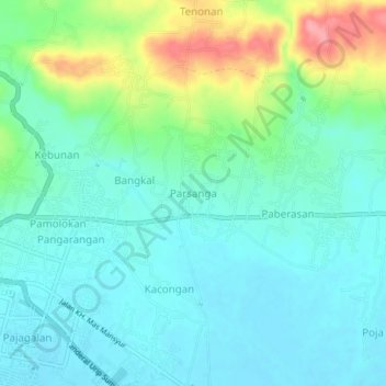
Name: Parsanga topographic map, elevation, terrain.
Location: Parsanga, Sumenep, East Java, Java, 69417, Indonesia (-7.01782 113.86199 -6.97782 113.90199)
Average elevation: 95 ft
Minimum elevation: 7 ft
Maximum elevation: 344 ft
Thank you for supporting this site ❤️
Make a donation
Make a donation
Gear up for your next adventure:
As an Amazon Associate, this site earns from qualifying purchases at no extra cost to you.