
Thank you for supporting this site ❤️
Make a donation
Make a donation
Gear up for your next adventure:
As an Amazon Associate, this site earns from qualifying purchases at no extra cost to you.
Mirasol topographic map
Click on the map to display elevation.
Thank you for supporting this site ❤️
Make a donation
Make a donation
Gear up for your next adventure:
As an Amazon Associate, this site earns from qualifying purchases at no extra cost to you.
About this map
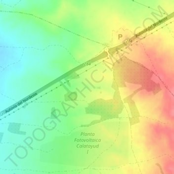
Name: Mirasol topographic map, elevation, terrain.
Location: Mirasol, Calatorao, Valdejalón, Zaragoza, Aragon, Spain (41.52187 -1.25623 41.54187 -1.23623)
Average elevation: 1,342 ft
Minimum elevation: 1,230 ft
Maximum elevation: 1,460 ft
Thank you for supporting this site ❤️
Make a donation
Make a donation
Gear up for your next adventure:
As an Amazon Associate, this site earns from qualifying purchases at no extra cost to you.