Geolocate

Maratea topographic map

Click on the map to display elevation.

About this map

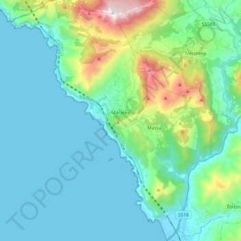
Name: Maratea topographic map, elevation, terrain.

Location: Maratea, Potenza, Basilicata, 85046, Italy (39.92260 15.64460 40.05492 15.79027)

Average elevation: 932 ft

Minimum elevation: 0 ft

Maximum elevation: 4,941 ft

Other topographic maps

Click on a map to view its topography, its elevation and its terrain.

Agri

Italy > Basilicata > Potenza > San Martino d'Agri

Average elevation: 1,611 ft

Gear up for your next adventure:

😴Insulated Sleeping Pads - Compact and warm pads for high-elevation camping
🔦Compact Flashlight - Reliable flashlight for emergencies
🌡️Handheld Weather Meters - Measure wind, temp, and pressure for safe mountain travel
🔦LED Headlamp - Bright and durable LED headlamp for night navigation
🖼️Topo Map Wall Art - Decorative topographic prints of famous peaks and regions

As an Amazon Associate, this site earns from qualifying purchases at no extra cost to you.