
Thank you for supporting this site ❤️
Make a donation
Make a donation
Gear up for your next adventure:
As an Amazon Associate, this site earns from qualifying purchases at no extra cost to you.
Lapin topographic map
Click on the map to display elevation.
Thank you for supporting this site ❤️
Make a donation
Make a donation
Gear up for your next adventure:
As an Amazon Associate, this site earns from qualifying purchases at no extra cost to you.
About this map
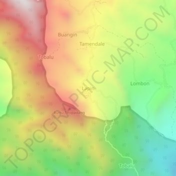
Name: Lapin topographic map, elevation, terrain.
Location: Lapin, Enrekang, Süd-Sulawesi, Sulawesi, Indonesien (-3.51910 119.84210 -3.47910 119.88210)
Average elevation: 3,153 ft
Minimum elevation: 1,309 ft
Maximum elevation: 5,102 ft
Thank you for supporting this site ❤️
Make a donation
Make a donation
Gear up for your next adventure:
As an Amazon Associate, this site earns from qualifying purchases at no extra cost to you.