
Magnolia topographic map
Click on the map to display elevation.
Magnolia
Magnolia is located in southwest Arkansas, north of the center of Columbia County. The average altitude is 336 ft (102 m) above sea level according to NOAA. The surrounding region is a mix of dense forest, farm prairies, and low rolling hills.
About this map
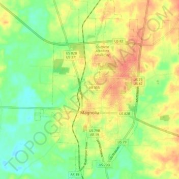
Name: Magnolia topographic map, elevation, terrain.
Location: Magnolia, Columbia County, Arkansas, United States (33.23838 -93.26766 33.31554 -93.18919)
Average elevation: 299 ft
Minimum elevation: 217 ft
Maximum elevation: 384 ft
Columbia County trails, hiking, mountain biking, running and outdoor activities
Other topographic maps
Click on a map to view its topography, its elevation and its terrain.