
Thank you for supporting this site ❤️
Make a donation
Make a donation
Gear up for your next adventure:
As an Amazon Associate, this site earns from qualifying purchases at no extra cost to you.
Monterralo topographic map
Click on the map to display elevation.
Thank you for supporting this site ❤️
Make a donation
Make a donation
Gear up for your next adventure:
As an Amazon Associate, this site earns from qualifying purchases at no extra cost to you.
About this map
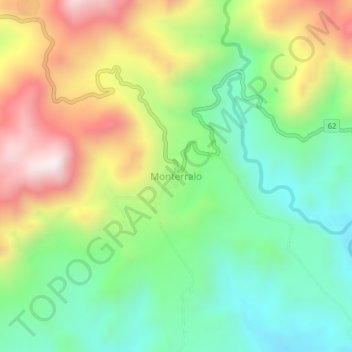
Name: Monterralo topographic map, elevation, terrain.
Location: Monterralo, Aguazul, Casanare, RAP Llanos, Colombia (5.20666 -72.69361 5.24666 -72.65361)
Average elevation: 2,690 ft
Minimum elevation: 1,696 ft
Maximum elevation: 4,219 ft
Thank you for supporting this site ❤️
Make a donation
Make a donation
Gear up for your next adventure:
As an Amazon Associate, this site earns from qualifying purchases at no extra cost to you.