
Thank you for supporting this site ❤️
Make a donation
Make a donation
Gear up for your next adventure:
As an Amazon Associate, this site earns from qualifying purchases at no extra cost to you.
Bretby topographic map
Click on the map to display elevation.
Thank you for supporting this site ❤️
Make a donation
Make a donation
Gear up for your next adventure:
As an Amazon Associate, this site earns from qualifying purchases at no extra cost to you.
About this map
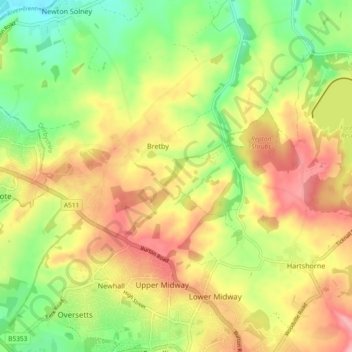
Name: Bretby topographic map, elevation, terrain.
Location: Bretby, South Derbyshire, Derbyshire, England, United Kingdom (52.78443 -1.61443 52.81948 -1.52165)
Average elevation: 331 ft
Minimum elevation: 128 ft
Maximum elevation: 541 ft
Thank you for supporting this site ❤️
Make a donation
Make a donation
Gear up for your next adventure:
As an Amazon Associate, this site earns from qualifying purchases at no extra cost to you.