Geolocate

Cut-cot topographic map

Click on the map to display elevation.

About this map

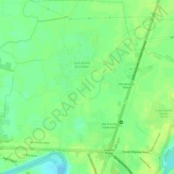
Name: Cut-cot topographic map, elevation, terrain.

Location: Cut-cot, Pulilan, Bulacan, Central Luzon, Philippines (14.89814 120.85925 14.92624 120.87249)

Average elevation: 33 ft

Minimum elevation: 0 ft

Maximum elevation: 49 ft

Other topographic maps

Click on a map to view its topography, its elevation and its terrain.

Dulong Malabon

Philippines > Bulacan > Pulilan

Average elevation: 20 ft

Gear up for your next adventure:

🧭Map Reading Tools - Tools and kits for map navigation
🌐World Map Poster - Decorative world maps with topographic info
👖Convertible Hiking Pants - Versatile zip-off pants for changing altitudes and temperatures
🔭Telescopic Hiking Pole - Adjustable pole for hiking stability
Backpacking Tents - Weight-optimized shelters for multi-day topographic surveys

As an Amazon Associate, this site earns from qualifying purchases at no extra cost to you.