Geolocate

Delphos topographic map

Click on the map to display elevation.

About this map

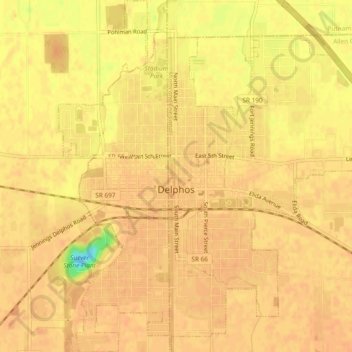
Name: Delphos topographic map, elevation, terrain.

Location: Delphos, Allen County, Ohio, 45833, United States (40.82723 -84.35553 40.86284 -84.30942)

Average elevation: 774 ft

Minimum elevation: 679 ft

Maximum elevation: 787 ft

Allen County trails, hiking, mountain biking, running and outdoor activities

Gear up for your next adventure:

🌐World Map Poster - Decorative world maps with topographic info
🧣Merino Neck Gaiters - Multi-functional headwear for wind and sun protection
🕶️Glacier Sunglasses - Side shields to protect eyes from high-altitude snow glare
🦶Carbon Trekking Poles - Reduce knee impact on steep descents with ultra-light poles
🧤Hiking Gloves - Protective gloves for rugged trails

As an Amazon Associate, this site earns from qualifying purchases at no extra cost to you.