
Thank you for supporting this site ❤️
Make a donation
Make a donation
Gear up for your next adventure:
As an Amazon Associate, this site earns from qualifying purchases at no extra cost to you.
Stroud topographic map
Click on the map to display elevation.
Thank you for supporting this site ❤️
Make a donation
Make a donation
Gear up for your next adventure:
As an Amazon Associate, this site earns from qualifying purchases at no extra cost to you.
About this map
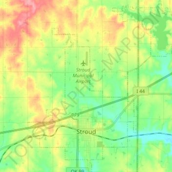
Name: Stroud topographic map, elevation, terrain.
Location: Stroud, Lincoln County, Oklahoma, 74079, United States (35.72426 -96.69862 35.82409 -96.58942)
Average elevation: 892 ft
Minimum elevation: 778 ft
Maximum elevation: 1,053 ft
Lincoln County trails, hiking, mountain biking, running and outdoor activities
Thank you for supporting this site ❤️
Make a donation
Make a donation
Gear up for your next adventure:
As an Amazon Associate, this site earns from qualifying purchases at no extra cost to you.