
Thank you for supporting this site ❤️
Make a donation
Make a donation
Gear up for your next adventure:
As an Amazon Associate, this site earns from qualifying purchases at no extra cost to you.
Vallapuzha topographic map
Click on the map to display elevation.
Thank you for supporting this site ❤️
Make a donation
Make a donation
Gear up for your next adventure:
As an Amazon Associate, this site earns from qualifying purchases at no extra cost to you.
About this map
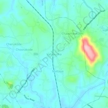
Name: Vallapuzha topographic map, elevation, terrain.
Location: Vallapuzha, Pattambi, Palakkad District, Kerala, 679335, India (10.81995 76.23261 10.85995 76.27261)
Average elevation: 184 ft
Minimum elevation: 79 ft
Maximum elevation: 679 ft
Thank you for supporting this site ❤️
Make a donation
Make a donation
Gear up for your next adventure:
As an Amazon Associate, this site earns from qualifying purchases at no extra cost to you.