
Keystone topographic map
Click on the map to display elevation.
About this map
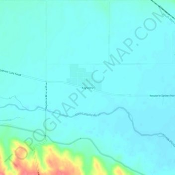
Name: Keystone topographic map, elevation, terrain.
Location: Keystone, Keith County, Nebraska, 69144, United States (41.19608 -101.60376 41.23608 -101.56376)
Average elevation: 3,114 ft
Minimum elevation: 3,081 ft
Maximum elevation: 3,301 ft
Keith County trails, hiking, mountain biking, running and outdoor activities
Other topographic maps
Click on a map to view its topography, its elevation and its terrain.