
Thank you for supporting this site ❤️
Make a donation
Make a donation
Gear up for your next adventure:
As an Amazon Associate, this site earns from qualifying purchases at no extra cost to you.
Omalo topographic map
Click on the map to display elevation.
Thank you for supporting this site ❤️
Make a donation
Make a donation
Gear up for your next adventure:
As an Amazon Associate, this site earns from qualifying purchases at no extra cost to you.
About this map
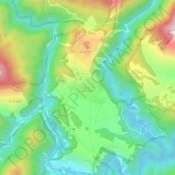
Name: Omalo topographic map, elevation, terrain.
Location: Omalo, Akhmeta Municipality, Kakheti, Georgia (42.35077 45.61346 42.39077 45.65346)
Average elevation: 6,138 ft
Minimum elevation: 5,282 ft
Maximum elevation: 7,776 ft
Thank you for supporting this site ❤️
Make a donation
Make a donation
Gear up for your next adventure:
As an Amazon Associate, this site earns from qualifying purchases at no extra cost to you.