Geolocate

L'Anse topographic map

Click on the map to display elevation.

About this map

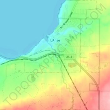
Name: L'Anse topographic map, elevation, terrain.

Location: L'Anse, L'Anse Township, Baraga County, Michigan, 49946, United States (46.72964 -88.47003 46.77213 -88.42796)

Average elevation: 735 ft

Minimum elevation: 584 ft

Maximum elevation: 1,004 ft

Baraga County trails, hiking, mountain biking, running and outdoor activities

Other topographic maps

Click on a map to view its topography, its elevation and its terrain.

Skanee

United States > Michigan > Baraga County

Average elevation: 715 ft

Zeba

United States > Michigan > Baraga County

Average elevation: 764 ft

Watton

United States > Michigan > Baraga County > Covington Township

Average elevation: 1,463 ft

Pelkie

United States > Michigan > Baraga County

Average elevation: 696 ft

Nestoria

United States > Michigan > Baraga County > Covington Township

Average elevation: 1,693 ft

Three Lakes

United States > Michigan > Baraga County

Average elevation: 1,680 ft

Gear up for your next adventure:

🧺Microfiber Travel Towels - Compact and fast-drying towels for trail use
🔥Fast-Boil Camping Stoves - Efficient cooking systems for quick trail meals
🔥Camping Stove - Portable stove for camping and backcountry cooking
🪓Survival Multi‑Tool - Versatile tool for camp and trail tasks
🪶Compact Camp Shovel - Folding shovel for campsite tasks

As an Amazon Associate, this site earns from qualifying purchases at no extra cost to you.