
Make a donation
Gear up for your next adventure:
As an Amazon Associate, this site earns from qualifying purchases at no extra cost to you.
Danzwiesen topographic map
Click on the map to display elevation.
Make a donation
Gear up for your next adventure:
As an Amazon Associate, this site earns from qualifying purchases at no extra cost to you.
Danzwiesen
In der Karwoche des Jahres 1945, kurz vor Ende des Zweiten Weltkrieges, wurden auf die Anhöhe von Danzwiesen Flakgeschütze gebracht. Damit sollte ein Zug vor Tieffliegern geschützt werden, der sich im nahe gelegenen Milseburgtunnel befand. Von dort aus versuchten hochrangige deutsche Offiziere und Soldaten, eine Gegenwehr gegen die vorrückenden Amerikaner zu organisieren.
Make a donation
Gear up for your next adventure:
As an Amazon Associate, this site earns from qualifying purchases at no extra cost to you.
About this map
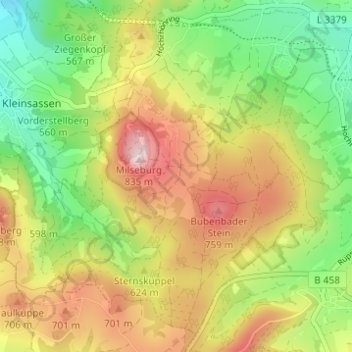
Name: Danzwiesen topographic map, elevation, terrain.
Location: Danzwiesen, Hofbieber, Landkreis Fulda, Hessen, Deutschland (50.52509 9.85789 50.56048 9.91936)
Average elevation: 1,995 ft
Minimum elevation: 1,457 ft
Maximum elevation: 2,648 ft
Make a donation
Gear up for your next adventure:
As an Amazon Associate, this site earns from qualifying purchases at no extra cost to you.
Other topographic maps
Click on a map to view its topography, its elevation and its terrain.