
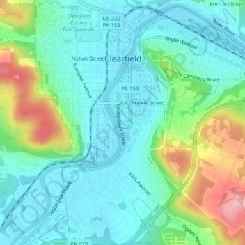
Clearfield topographic map
Click on the map to display elevation.
About this map
Name: Clearfield topographic map, elevation, terrain.
Average elevation: 1,214 ft
Minimum elevation: 1,093 ft
Maximum elevation: 1,542 ft
Clearfield County trails, hiking, mountain biking, running and outdoor activities
Other topographic maps
Click on a map to view its topography, its elevation and its terrain.
Home Camp
United States > Pennsylvania > Clearfield County > Union Township
Average elevation: 1,762 ft
Barrett
United States > Pennsylvania > Clearfield County > Bradford Township
Average elevation: 1,352 ft
Utahville
United States > Pennsylvania > Clearfield County > Beccaria Township > Utahville
Average elevation: 1,650 ft
Anderson
United States > Pennsylvania > Clearfield County > Union Township > Anderson
Average elevation: 1,811 ft
Parsonsville
United States > Pennsylvania > Clearfield County > Decatur Township
Average elevation: 1,627 ft
Grassflat
United States > Pennsylvania > Clearfield County > Cooper Township
Average elevation: 1,572 ft
Bigler
United States > Pennsylvania > Clearfield County > Bradford Township
Average elevation: 1,729 ft
Hawk Run
United States > Pennsylvania > Clearfield County > Morris Township
Average elevation: 1,493 ft
Oklahoma
United States > Pennsylvania > Clearfield County > Sandy Township
Average elevation: 1,470 ft
West Decatur
United States > Pennsylvania > Clearfield County > Boggs Township
Average elevation: 1,670 ft
Beccaria
United States > Pennsylvania > Clearfield County > Beccaria Township
Average elevation: 1,532 ft
Karthaus
United States > Pennsylvania > Clearfield County > Karthaus Township
Average elevation: 1,171 ft
Lecontes Mills
United States > Pennsylvania > Clearfield County > Girard Township
Average elevation: 1,391 ft
Luthersburg
United States > Pennsylvania > Clearfield County > Brady Township
Average elevation: 1,765 ft
New Millport
United States > Pennsylvania > Clearfield County > Knox Township
Average elevation: 1,549 ft
Pottersdale
United States > Pennsylvania > Clearfield County > Karthaus Township
Average elevation: 1,293 ft
Smoke Run
United States > Pennsylvania > Clearfield County > Bigler Township
Average elevation: 1,496 ft
Winburne
United States > Pennsylvania > Clearfield County > Cooper Township
Average elevation: 1,519 ft
Woodland
United States > Pennsylvania > Clearfield County > Bradford Township
Average elevation: 1,657 ft