Geolocate

Passo Corese topographic map

Click on the map to display elevation.

About this map

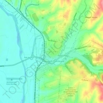
Name: Passo Corese topographic map, elevation, terrain.

Location: Passo Corese, Fara in Sabina, Rieti, Lazio, 02032, Italia (42.13535 12.63221 42.17535 12.67221)

Average elevation: 157 ft

Minimum elevation: 52 ft

Maximum elevation: 377 ft

Gear up for your next adventure:

📻Weather Alert Radios - Stay informed of storm risks while off-the-grid
GPS Sports Watch - GPS watch for running, hiking and training
🧥Waterproof Jacket for Hiking - Breathable and rugged rain jacket for outdoor excursions
🌎3D Topographic Globes - Raised relief globes for a tactile understanding of geography
🗃️Trail First Aid Kit - Essential kit for outdoor injuries and emergencies

As an Amazon Associate, this site earns from qualifying purchases at no extra cost to you.