Geolocate

Pāʻea topographic map

Click on the map to display elevation.

About this map

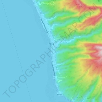
Name: Pāʻea topographic map, elevation, terrain.

Location: Pāʻea, Windward Islands, French Polynesia, 98711, France (-17.74743 -149.59634 -17.64485 -149.50062)

Average elevation: 827 ft

Minimum elevation: 0 ft

Maximum elevation: 4,793 ft

Other topographic maps

Click on a map to view its topography, its elevation and its terrain.

Maraa

France > French Polynesia > Windward Islands > Punaʻauiʻa

Average elevation: 2,224 ft

Gear up for your next adventure:

🥩Freeze-Dried Meals - Nutritious and lightweight food for remote expeditions
🧭Orienteering Set - Complete compass and map reading kit
🛠️Outdoor Gear Repair Kit - Essential tools to fix gear on the trail
🎒Hydration Pack - Hands‑free water reservoir for long hikes
Camping Coffee Makers - Enjoy premium coffee at the summit or campsite

As an Amazon Associate, this site earns from qualifying purchases at no extra cost to you.