Geolocate

Greenock topographic map

Click on the map to display elevation.

About this map

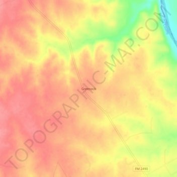
Name: Greenock topographic map, elevation, terrain.

Location: Greenock, Bosque County, Texas, United States (31.74627 -97.36557 31.78627 -97.32557)

Average elevation: 597 ft

Minimum elevation: 410 ft

Maximum elevation: 676 ft

Bosque County trails, hiking, mountain biking, running and outdoor activities

Other topographic maps

Click on a map to view its topography, its elevation and its terrain.

Walnut Springs

United States > Texas > Bosque County

Average elevation: 942 ft

Cranfills Gap

United States > Texas > Bosque County

Average elevation: 997 ft

Iredell

United States > Texas > Bosque County

Average elevation: 912 ft

Meridian

United States > Texas > Bosque County

Average elevation: 804 ft

Morgan

United States > Texas > Bosque County

Average elevation: 745 ft

Clifton

United States > Texas > Bosque County

Average elevation: 715 ft

Gear up for your next adventure:

🪶Survival Guide Book - Expert advice for emergency preparedness
📷Action Camera - Capture your outdoor adventures in HD
🧣Merino Neck Gaiters - Multi-functional headwear for wind and sun protection
🦶Carbon Trekking Poles - Reduce knee impact on steep descents with ultra-light poles
🏕️Family Camping Gear - Essentials for group camping trips

As an Amazon Associate, this site earns from qualifying purchases at no extra cost to you.