Geolocate

Welby topographic map

Click on the map to display elevation.

About this map

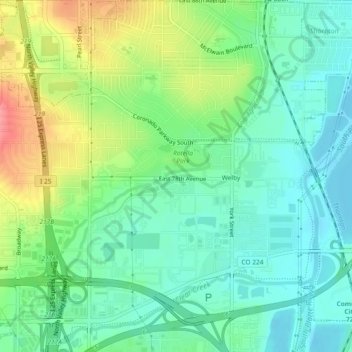
Name: Welby topographic map, elevation, terrain.

Location: Welby, Adams County, Colorado, United States (39.82056 -104.98494 39.85617 -104.94192)

Average elevation: 5,167 ft

Minimum elevation: 5,079 ft

Maximum elevation: 5,348 ft

Adams County trails, hiking, mountain biking, running and outdoor activities

Gear up for your next adventure:

🛰️Satellite Messengers - Emergency SOS and two-way messaging for off-grid adventures
🔦LED Headlamp - Bright and durable LED headlamp for night navigation
🎒Gear Packing Cubes - Organize your backpack efficiently
🍳Camping Cook Set - Complete cookware for outdoor meals
🪶Trail Camera - Capture wildlife on your hikes

As an Amazon Associate, this site earns from qualifying purchases at no extra cost to you.