
Thank you for supporting this site ❤️
Make a donation
Make a donation
Gear up for your next adventure:
As an Amazon Associate, this site earns from qualifying purchases at no extra cost to you.
Tikorangi topographic map
Click on the map to display elevation.
Thank you for supporting this site ❤️
Make a donation
Make a donation
Gear up for your next adventure:
As an Amazon Associate, this site earns from qualifying purchases at no extra cost to you.
About this map
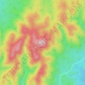
Name: Tikorangi topographic map, elevation, terrain.
Location: Tikorangi, Whakatāne District, Bay of Plenty, New Zealand (-38.58508 176.72982 -38.58498 176.72992)
Average elevation: 1,588 ft
Minimum elevation: 1,083 ft
Maximum elevation: 2,106 ft
Thank you for supporting this site ❤️
Make a donation
Make a donation
Gear up for your next adventure:
As an Amazon Associate, this site earns from qualifying purchases at no extra cost to you.