Geolocate

Two Rivers topographic map

Click on the map to display elevation.

About this map

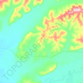
Name: Two Rivers topographic map, elevation, terrain.

Location: Two Rivers, Fairbanks North Star, Alaska, 99716, United States (64.85213 -147.26985 64.93897 -146.94620)

Average elevation: 745 ft

Minimum elevation: 476 ft

Maximum elevation: 1,814 ft

Fairbanks North Star trails, hiking, mountain biking, running and outdoor activities

Other topographic maps

Click on a map to view its topography, its elevation and its terrain.

Harding Lake

United States > Alaska > Fairbanks North Star

Average elevation: 761 ft

Fairbanks

United States > Alaska > Fairbanks North Star

Average elevation: 709 ft

Badger

United States > Alaska > Fairbanks North Star

Average elevation: 472 ft

College

United States > Alaska > Fairbanks North Star

Average elevation: 459 ft

Chatanika

United States > Alaska > Fairbanks North Star

Located 2 miles (3.2 km) east of the confluence of Cleary Creek and the Chatanika River, Chatanika lies 20 miles (32 km) northeast of Fairbanks. Its altitude is 896 feet (273 m).

Average elevation: 892 ft

Gear up for your next adventure:

🔪Outdoor Multitools - Essential survival tools for gear repair and field use
🛡️Bear Spray Outdoor - Protection in bear country hikes
🏕️Tent Footprint - Protect your tent base from wear
⛑️Personal Locator Beacon - Safety beacon for emergencies
🚪Portable Camp Chair - Foldable chair for comfort at camp

As an Amazon Associate, this site earns from qualifying purchases at no extra cost to you.