Geolocate

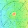
Cheekha Dar topographic map

Click on the map to display elevation.

Cheekha Dar

It was climbed in November 2004 by English explorer Ginge Fullen, who recorded a GPS reading of 3,628 meters at the coordinates in the adjacent table. The location is consistent with SRTM and Russian topographic mapping, although these sources are more consistent with the CIA height.

Wikipedia (CC-BY-SA 3.0)

About this map

Name: Cheekha Dar topographic map, elevation, terrain.

Location: Cheekha Dar, Haji Omeran Subdistrict, Choman District, Erbil Governorate, Iraqi Kurdistan Region, Iraq (36.77547 44.91884 36.77557 44.91894)

Average elevation: 10,384 ft

Minimum elevation: 8,488 ft

Maximum elevation: 11,818 ft

Other topographic maps

Click on a map to view its topography, its elevation and its terrain.

Khabat

Iraq > Erbil Governorate

Average elevation: 968 ft

Citadel of Erbil

Iraq > Erbil Governorate > Erbil

Average elevation: 1,345 ft

Mergasur District

Iraq > Erbil Governorate

Average elevation: 4,318 ft

Salah Ad Din

Iraq > Erbil Governorate

Average elevation: 3,386 ft

Qushtapa

Iraq > Erbil Governorate > Qushtapa District

Average elevation: 1,299 ft

Harir Subdistrict

Iraq > Erbil Governorate

Average elevation: 2,904 ft

Baharka Subdistrict

Iraq > Erbil Governorate

Average elevation: 1,716 ft

Shaqlawa District

Iraq > Erbil Governorate

Average elevation: 2,602 ft

Rubari Koya

Iraq > Erbil Governorate > Koy Sanjaq

Average elevation: 1,775 ft

Sidakan

Iraq > Erbil Governorate

Average elevation: 3,330 ft

Soran district

Iraq > Erbil Governorate

Average elevation: 2,320 ft

کۆڕەک

Iraq > Erbil Governorate

Average elevation: 7,772 ft

Soran district

Iraq > Erbil Governorate

Average elevation: 2,320 ft

Soran District

Iraq > Erbil Governorate

Average elevation: 5,764 ft

Mila Omer

Iraq > Erbil Governorate

Average elevation: 827 ft

Khabat District

Iraq > Erbil Governorate

Average elevation: 1,053 ft

Erbil Plains District

Iraq > Erbil Governorate

Average elevation: 1,588 ft

Ankawa

Iraq > Erbil Governorate

Average elevation: 1,368 ft

Massif Saladin Subdistrict

Iraq > Erbil Governorate

Average elevation: 2,503 ft

Kasnazan Park

Iraq > Erbil Governorate > کەسنەزان

Average elevation: 1,932 ft

Mergasur District

Iraq > Erbil Governorate

Average elevation: 4,318 ft

Shero

Iraq > Erbil Governorate > Qushtapa District

Average elevation: 1,299 ft

Soran district

Iraq > Erbil Governorate

Average elevation: 2,320 ft

Shanadar Park

Iraq > Erbil Governorate > Erbil اربيل

Average elevation: 1,325 ft

Khanzad (Banaman) Citadel

Iraq > Erbil Governorate > Banaman

Average elevation: 2,444 ft

Sami Abdulrahman Park

Iraq > Erbil Governorate > Erbil

Average elevation: 1,296 ft

Gear up for your next adventure:

🛰️Handheld GPS Units - Professional satellite navigators for precise backcountry mapping
📶Vehicle Signal Boosters - Improve reception in rural areas while driving to trailheads
🎒Waterproof Dry Bags - Keep your electronics and maps dry inside your pack
🧯Portable Fire Pit - Compact fire pit for camping spots
🧭Pro Hiking Compasses - High-accuracy liquid-filled compasses for topographic orientation

As an Amazon Associate, this site earns from qualifying purchases at no extra cost to you.