
Jamul topographic map
Click on the map to display elevation.
About this map
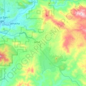
Name: Jamul topographic map, elevation, terrain.
Location: Jamul, San Diego County, California, 91935, United States (32.68454 -116.94073 32.74646 -116.80440)
Average elevation: 1,099 ft
Minimum elevation: 318 ft
Maximum elevation: 2,779 ft
San Diego County trails, hiking, mountain biking, running and outdoor activities