Geolocate

Eibach topographic map

Click on the map to display elevation.

About this map

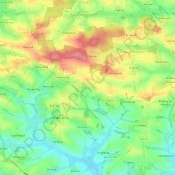
Name: Eibach topographic map, elevation, terrain.

Location: Eibach, Dorfen, Landkreis Erding, Bayern, 84405, Deutschland (48.28492 12.13495 48.32492 12.17495)

Average elevation: 1,578 ft

Minimum elevation: 1,444 ft

Maximum elevation: 1,745 ft

Gear up for your next adventure:

👓Polarized Sunglasses - Outdoor sunglasses for glare reduction
🧷Carabiner Set - Durable clips for gear attachment
🧺Microfiber Travel Towels - Compact and fast-drying towels for trail use
Backpacking Tent - Lightweight and durable tent for multi‑day hikes
Camping Coffee Makers - Enjoy premium coffee at the summit or campsite

As an Amazon Associate, this site earns from qualifying purchases at no extra cost to you.