
Thank you for supporting this site ❤️
Make a donation
Make a donation
Gear up for your next adventure:
As an Amazon Associate, this site earns from qualifying purchases at no extra cost to you.
Yangnim-dong topographic map
Click on the map to display elevation.
Thank you for supporting this site ❤️
Make a donation
Make a donation
Gear up for your next adventure:
As an Amazon Associate, this site earns from qualifying purchases at no extra cost to you.
About this map
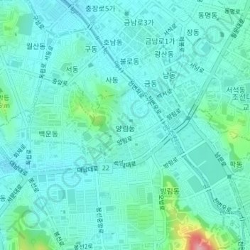
Name: Yangnim-dong topographic map, elevation, terrain.
Location: Yangnim-dong, Nam-gu, Gwangju, 61662, South Korea (35.13437 126.90867 35.14298 126.92031)
Average elevation: 203 ft
Minimum elevation: 125 ft
Maximum elevation: 597 ft
Thank you for supporting this site ❤️
Make a donation
Make a donation
Gear up for your next adventure:
As an Amazon Associate, this site earns from qualifying purchases at no extra cost to you.