Geolocate

Cehegín topographic map

Click on the map to display elevation.

About this map
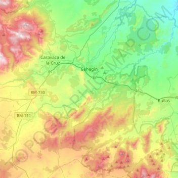
Name: Cehegín topographic map, elevation, terrain.

Location: Cehegín, Noroeste, Region of Murcia, 30430, Spain (37.94479 -1.83329 38.18584 -1.62568)

Average elevation: 2,375 ft

Minimum elevation: 1,053 ft

Maximum elevation: 4,626 ft

Other topographic maps

Click on a map to view its topography, its elevation and its terrain.

Casas de Aledo

Spain > Region of Murcia > Noroeste > Moratalla

Average elevation: 3,953 ft

Obispo

Spain > Region of Murcia > Noroeste > Moratalla

Average elevation: 5,761 ft

Gear up for your next adventure:

⛺Backpacking Tent - Lightweight and durable tent for multi‑day hikes
🧣Merino Neck Gaiters - Multi-functional headwear for wind and sun protection
🧦Merino Wool Socks - Moisture-wicking, blister-preventing socks for long treks
🧭Hiking Compass - Precision compass for reliable navigation in the wilderness
👓Polarized Sunglasses - Outdoor sunglasses for glare reduction

As an Amazon Associate, this site earns from qualifying purchases at no extra cost to you.