
Thank you for supporting this site ❤️
Make a donation
Make a donation
Gear up for your next adventure:
As an Amazon Associate, this site earns from qualifying purchases at no extra cost to you.
Cranston topographic map
Click on the map to display elevation.
Thank you for supporting this site ❤️
Make a donation
Make a donation
Gear up for your next adventure:
As an Amazon Associate, this site earns from qualifying purchases at no extra cost to you.
About this map
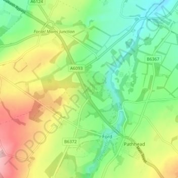
Name: Cranston topographic map, elevation, terrain.
Location: Cranston, Ford, Midlothian, Scotland, EH37 5UB, United Kingdom (55.85955 -3.00571 55.89955 -2.96571)
Average elevation: 505 ft
Minimum elevation: 279 ft
Maximum elevation: 856 ft
Thank you for supporting this site ❤️
Make a donation
Make a donation
Gear up for your next adventure:
As an Amazon Associate, this site earns from qualifying purchases at no extra cost to you.