
Oudsbergen topographic map
Interactive map
Click on the map to display elevation.
About this map
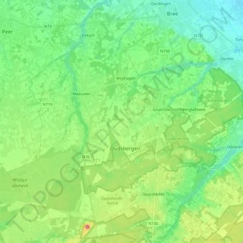
Name: Oudsbergen topographic map, elevation, terrain.
Location: Oudsbergen, Maaseik, Limburg, Vlaanderen, België (51.01877 5.45438 51.14635 5.66607)
Average elevation: 226 ft
Minimum elevation: 112 ft
Maximum elevation: 509 ft
Other topographic maps
Click on a map to view its topography, its elevation and its terrain.
Opglabbeek
België > Limburg > Maaseik > Oudsbergen
Opglabbeek, Oudsbergen, Maaseik, Limburg, Vlaanderen, 3660, België
Average elevation: 259 ft
Gruitrode
België > Limburg > Maaseik > Oudsbergen
Gruitrode, Oudsbergen, Maaseik, Limburg, België
Average elevation: 233 ft