Geolocate

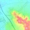
Knightcote topographic map

Click on the map to display elevation.

About this map

Name: Knightcote topographic map, elevation, terrain.

Location: Knightcote, Burton Dassett CP, Northend, Stratford-on-Avon, Warwickshire, England, CV47 2SF, United Kingdom (52.16739 -1.43741 52.20739 -1.39741)

Average elevation: 331 ft

Minimum elevation: 285 ft

Maximum elevation: 574 ft

Other topographic maps

Click on a map to view its topography, its elevation and its terrain.
Gear up for your next adventure:

🛡️Insect Repellent - Protection against bugs during outdoor activities
🥾Men's Hiking Boots - Durable, waterproof footwear for rugged terrain and steep inclines
🚁Photography Drones - Capture stunning aerial views of landforms and topography
🌎3D Topographic Globes - Raised relief globes for a tactile understanding of geography
🧭Compass with Lanyard - Easy‑carry compass for navigation

As an Amazon Associate, this site earns from qualifying purchases at no extra cost to you.