Geolocate

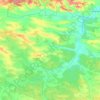
Stanyn topographic map

Click on the map to display elevation.

About this map

Name: Stanyn topographic map, elevation, terrain.

Location: Stanyn, Radekhiv Urban Hromada, Sheptytskyi Raion, Lviv Oblast, 80250, Ukraine (50.25806 24.54739 50.29806 24.58739)

Average elevation: 761 ft

Minimum elevation: 715 ft

Maximum elevation: 820 ft

Other topographic maps

Click on a map to view its topography, its elevation and its terrain.

Gear up for your next adventure:

🍳Camping Cook Set - Complete cookware for outdoor meals
🎒Gear Packing Cubes - Organize your backpack efficiently
🧭Hiking Compass - Precision compass for reliable navigation in the wilderness
🎁Geography Themed Gifts - Unique gift ideas for map lovers and geography enthusiasts
🪶Camping Sleeping Pad - Comfortable sleeping pad for backpacking

As an Amazon Associate, this site earns from qualifying purchases at no extra cost to you.