
谋道镇 topographic map
Interactive map
Click on the map to display elevation.
About this map
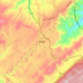
Name: 谋道镇 topographic map, elevation, terrain.
Location: 谋道镇, 利川市, 恩施土家族苗族自治州, 湖北省, 中国 (30.39575 108.64113 30.47575 108.72113)
Average elevation: 4,495 ft
Minimum elevation: 2,772 ft
Maximum elevation: 5,705 ft
Other topographic maps
Click on a map to view its topography, its elevation and its terrain.