
Thank you for supporting this site ❤️
Make a donation
Make a donation
Gear up for your next adventure:
As an Amazon Associate, this site earns from qualifying purchases at no extra cost to you.
Wangqing topographic map
Click on the map to display elevation.
Thank you for supporting this site ❤️
Make a donation
Make a donation
Gear up for your next adventure:
As an Amazon Associate, this site earns from qualifying purchases at no extra cost to you.
About this map
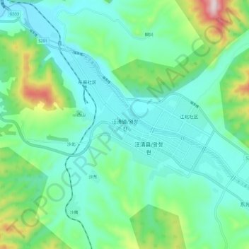
Name: Wangqing topographic map, elevation, terrain.
Location: Wangqing, Wangqing County, Yanbian, Jilin, China (43.27781 129.71063 43.35781 129.79063)
Average elevation: 1,030 ft
Minimum elevation: 679 ft
Maximum elevation: 2,221 ft
Thank you for supporting this site ❤️
Make a donation
Make a donation
Gear up for your next adventure:
As an Amazon Associate, this site earns from qualifying purchases at no extra cost to you.