Geolocate

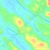
Chuttippara topographic map

Click on the map to display elevation.

About this map

Name: Chuttippara topographic map, elevation, terrain.

Location: Chuttippara, Kozhencherry, Pathanamthitta, Kerala, 689671, India (9.26474 76.79537 9.26484 76.79547)

Average elevation: 118 ft

Minimum elevation: 49 ft

Maximum elevation: 381 ft

Other topographic maps

Click on a map to view its topography, its elevation and its terrain.
Arattupuzha

India > Kerala > Kozhencherry > Malakkara

Average elevation: 39 ft

Prakkanam

India > Kerala > Kozhencherry > Prakkanam

Average elevation: 190 ft

Gear up for your next adventure:

🔋Rechargeable Batteries - Power up your outdoor devices
🧢Outdoor Hiking Hat - Sun protection hat for outdoor explorers
🎒Waterproof Dry Bags - Keep your electronics and maps dry inside your pack
🔊Portable Camp Speaker - Music and alerts at camp
🏕️Tent Footprint - Protect your tent base from wear

As an Amazon Associate, this site earns from qualifying purchases at no extra cost to you.